
See Results section for list of all stages, including Strava links.
 |
| Map (click for interactive) |
USA is a beautiful country with spectacular scenery, mostly friendly people, and a lot of culture. There was on beforehand some concern that cycling across USA on public roads could be dangerous. The risk of injury was calculated to 0.5%. Based on the experience, the actual calculated risk should be 10x higher, which just exemplifies my lax relationship with due process and proper risk management. In conclusion I would recommend traveling across USA, but either on rural cycling paths, or in a motorised vehicle. Going by bike requires considerable preparations with regard to finding safe routes, protection from the elements, and maintenance of equipment.
Traveling to Los Angeles
Like always, locking the front door and heading out into a huge unknown adventure was chilling. My bike was packed in a cardboard box (thanks, Oslo Sportslager), with pedals and front wheel disassembled. The packing list and travel plans were prepared months in advance, so there were no concern about forgetting anything. After a rather uncomfortable meeting with the TSA at LAX Airport, and a ride with a taxi driver that did not speak a single word english, I found my hotel room for the night, the Super 8 Wyndham.I got a bit stressed out when I figured I forgot the tool that was required to switch SIM cards on my mobile phone, and when I figured out I managed to bring an European cell phone charger. That made me think long and hard why I'm doing this, in a country far away from home, with no backup plans, and no allies. A visit to Home Depot the next day solved both problems. Sometimes I think I worry too much, but perhaps this is why I'm usually well-prepared.
 |
| A view from the NorwegianAir 787 Dreamliner. Beautiful airplane. Canada below. |
Click on the "map" link to view Strava map of the stage, which is the GPS-tracked actual route followed.
1. Los Angeles to Palmdale (map) - The beginning
California
Monday morning. I got up at 6 AM, ate a real american breakfast at the hotel, and cheered at the thought that while in America I could have waffles with syrup for breakfast every day. The day started with a 19km/12mi warm-up ride to Santa Monica Pier, where the official start would be. Once at the pier, there were be a few Skype calls with friends and loved ones, a few selfies, and a brief conversation with the Almighty one. No fear, no doubt, no troubles. Deep down I knew there'd be plenty of troubles, but they were ahead of me. Right now was the time for adventure.
 |
| Along Santa Monica Beach. |
 |
| Early morning at the pier. |
 |
| Walk of Fame. I found the star of Winnie the Pooh, my biggest hero. |
 |
| The Hollywood sign, as seen from Mt. Hollywood Drive. |
 |
| The landmark Griffith Observatory. |
 |
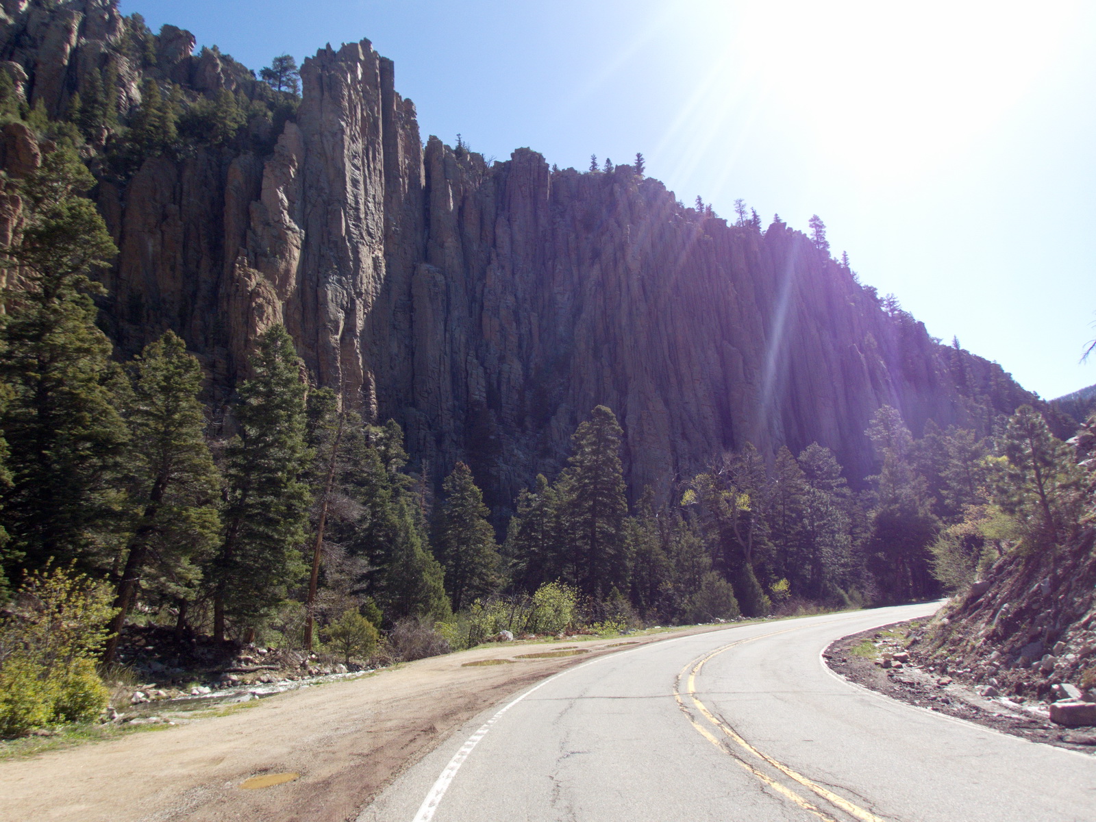
| Griffith Park, right next to Cathy's Corner. Note the decayed tarmac. |
My gear for the journey was my trusty Canyon CF SLX 2016, 25mm Continental GP4000 tires, SRAM-Quark GXP crankset, and a simple Apidura saddle bag. Note also the Canyon H36 Mini Tri armrest, which helped a bit but was overall an unnecessary investment.
 |
| San Gabriel mountains. |
The Griffith Observatory was closed on this day, and some CalTrans employees were quite eagerly trying to make me leave. I decided to detour through Griffith Park by Mt. Hollywood Drive. This road was closed to public traffic, had a tarmac road surface in very poor condition, but had nice views.
While in LA, I needed to figure out some of the traffic rules that applied here. For instance, turning right while having a red light is allowed. This caused some annoyance for other road users since I wasn't aware of this, and impeded traffic. My other realisation was that the road behaviour is quite aggressive - one simply does not yield to others out of kindness in LA.
Also, I'm pretty sure there were two young men that were thinking about lifting my wallet. They probably know a lycra-clad tourist when they see one. Fortunately, a death stare and a protective hand on my back pocket scared them away. Los Angeles is not a place for a soft cycling soul like myself. I was happy to get out of there.
The night was spent at Knights Inn Palmdale, with dinner at Pizza Hut. As an European, the whole concept of tipping is strange to me, but once I figured it out they even brought extra dressing to my table.
2. To Ridgecrest (map) - Through the Mojave desert.
CaliforniaAll the first stages had been preplanned using Strava Route Builder, in order to be certain there'd be no foul-ups with motels, hydration, and unsafe highways. Today would be a short day, with only 5 hours of riding. The reason for this was that this day could potentially involve bike repairs, or other unexpected delays. There were no delays, but legs were already tired, so the plan suited me well.
The stage went through Red Rock Canyon State Park, which was beautiful. A desert-like landscape quite unlike anything I've ever seen before.
 |
| Cycling path out of Palmdale. I had it all for myself. |
 |
| The train, the Sierra Nevadas, and the safe-lane I'd be riding on today. |
 |
| Strange to realise that people in this part of USA both look and talk like in GTA the computer game. |
 |
| Red Rock Canyon, with its bedrock colors peering out of the monotonous desert. |
 |
| The cacti was in full bloom. I wish my own potted cactus at home would show colors like this. |
While this day did not have any cultural highlights, it was easy to keep motivation just by seeing how the landscape changes, thinking about how different everything is, and trying to think of reasons not moving here at once.
Ridgecrest is right next to the China Lake military base, and the city seemed to be influenced by that. It didn't actually look like a city, though - it's more like a bunch of houses laid out in a grid. A nice indian (i.e. as a person from India) inn-keeper at A Nights's Inn welcomed me at today's cheap motel. He let me keep my bike in the room, which would be the norm for the rest of the trip.
Dinner #1 at Subday, and dinner #2 at Arby's. It was about this time I figured I might be consuming more calories than burnt while riding my bike, but the next day was long and hard so it might have been a good idea.
3. To Furnace Creek (map) - Valley of a thousand hairdriers.
CaliforniaGot up early at 5 AM, and had my breakfast which mostly consisted of sweet pastries, energy drinks and fruits that I got at a local market. By 6 AM, before the sun, I was already out. It's such a wonderful feeling, to beat the sun. I thought to myself, why I don't get up this early also on regular work-days at home.
The early hours took me into Searles Valley and Panamint Valley. northwards through a strange dry and flat landscape. Temperatures was around 20℃, until reaching Death Valley where it was 30℃ (86℉). That this day was so chilly was a stroke of luck - I was out of water well before reaching Death Valley's Stovepipe Springs. Any hotter and I would have been in trouble.
 |
| Early start, at China Lake. |
 |
| Not much exciting to look at in Trona, except the local art. |
 |
| Not sure what this red tarmac was, but it was a smooth ride. |
 |
| A thousand metre climb starting like this, could break most cyclists. |
 |
| The east side of the Towne Pass. |
 |
| Road signs can brighten up an otherwise dull view. |
 |
| Today supposedly was a "cold" day. Still hard to breathe. |
 |
| Strange salt-ish rock formations, quite outworldish. |
 |
| Furnace Creek is built on the valley's only fresh-water source. |
After passing the Towne Pass towards Death Valley, I was met by a ferocious wind from every direction. Combined with the 30℃ temperatures, it felt like having a thousand hair-driers pointing in my face all at once.
I slept at the Ranch at Death Valley, a rather overpriced place without any alternatives in the area. With the Air Conditioning, tap water supply, a modest grocery store, and most importantly, a pizza restaurant, all the hurt was forgotten. Also - I was quite happy to have reached a place I've dreamed about visiting.
4. To Pahrump (map)
California, NevadaAfter a difficult day into Death Valley, I was concerned about hydration on the next stage. Therefore, a decision was taken not to ride the Badwater Road, and instead go directly east to Death Valley Junction. This would involve climbing out of Death Valley early in the morning, reducing the risk of running out of water. Although being a bit safer, the Death Valley Junction route would still be 100 km (62 mi) with no service at all.
The risk posed by100 km with only two liters of water in this climate was huge, but it was still much better than riding towards Badwater.
 |
| "You're on your own, buddy." |
 |
| Zabriskie Point. Never seen anything like it! |
 |
| Two friendly Japanese on their way to Vegas. |
 |
| The east side of Death Valley had an enormous amount of butterflies. |
 |
| Salty flats near Ash Meadows, just before Nevada state line. |
 |
| Road down to Pahrump, Nevada. |
After four days on the bike, I was beginning to feel some fatigue, but not enough to consider a rest day. Once in Pahrump, I just relaxed for a few hours under a palm tree while on Skype, waiting for time to pass. It was good having friends at home who care for me. If I didn't, it would all feel a bit lonely. Everything seemed to be hanging in a balance between stable and slow travel towards success, and a ride down a abysmal path of failure.
Obey, legs, obey.
5. To Chloride (map) - Vegas, Hoover, and Dehydration.
Nevada, ArizonaThe fifth stage was planned to be a particularly long one. A difficult day, 230 km, with in excess of 2000 height meters. Hot temperatures, and long stretches without service.
And it was hot. Scorching hot.
Starting just before 6 AM, the first part of the day was through plains leading up to Las Vegas. With some stroke of luck, they were building a new 4-lane highway from Pahrump, which was closed to other traffic - so for 50 km I had two lanes of brand new tarmac only for myself and the occasional road construction crew, thundering through a completely empty and event-less landscape towards Las Vegas. On top of the Mountain Springs Summit, just before Las Vegas, the road narrowed into what easily could have been the end of any proficient cyclist, but a kind soul in a big red pickup truck defended me against other traffic down the valley by driving just behind me and preventing others from potentially dangerous overtaking.
Also confirmed several times after: Las Vegas has some of the kindest, warmest and most considerate people in the entire USA.
 |
| Maybe unintentional, but today it served as the best bike lane in the USA. |
 |
| Spring Summit, before Las Vegas. Remarkable colors and patterns. |
 |
| Quite a bit of cyclists in Las Vegas area. Excellent bike paths, too. |
 |
| Big bike. |
 |
| Hoover dam. What a big dam. |
 |
| State Road 93 towards Kingman. Not safe for cycling. |
 |
| Guns & Burgers had some interesting artwork on their walls. |
 |
| Sun is setting, and I still have many miles to Chloride. |
 |
| Tonight's entertainment. |
After visiting the Hoover Dam - which also was a life-long dream come true - the first obstacle was a closed road with a big fence saying trespassing prohibited on federal grounds. A detour would be an extra 20 km, so I considered my options and decided that it would be safer to climb the fence despite being a closed road. If they really mean that the road is closed, they'd better protect it better.
The second obstacle was the temperatures. No service and temperatures up to 38℃ (100℉) lead to quickly running out of water. When stopping at Guns & Burgers 50-60 km down the road, I was already dizzy and weak, and probably nearing where consciousness stops.
The third obstacle would be the road. The road towards Kingman simply did not have a safe lane, and trailers were passing with only centimetres between me and them. The solution would be to use the safe-lane on the opposite side of the road. This prompted a lot of reactions and honking from the oncoming traffic, but it was safer than the alternative.
Crazy day. Too dangerous. I felt a bit lucky to be alive, but that was mostly because I dislike taking chances.
6. To Seligman (map) - Route 66.
ArizonaAfter eating a simple oatmeal breakfast, I thundered down the busy highway towards Kingman. After a monumental effort the previous day, it hurt quite a bit to get on the bike, but 10 minutes into the stage all the difficult things were forgotten. Once in Kingman, I found that today was the annual Fun Run, with lots of veteran cars driving the Route 66 into Kingman. Totally unexpected, surprising, and fun.
Most of the day, I followed the historic Route 66 road, which is mostly rolling hills in the country-side. I even got a Strava KOM on a Route 66 hill, which brightened up the day a bit for a dinosaur cyclist like myself.
 |
| If you haven't figured, I like cactuses. |
 |
| Street decorations in Chloride. |
 |
| A historic gas station. |
 |
| The Fun Run ends in Kingman. Most of the fun appears to be showing your great-looking classic car to other enthusiasts. |
 |
| A fellow traveller from Israel. |
 |
| Sunset over Seligman. |
 |
| Route 66 decorations at Seligman. |
At Seligman, I slept at the Historic Route 66 Motel, which was only a regular motel, and had dinner at the Roadkill Cafe. I ordered the Roadside Remains burger, which was surprisingly good considering they promised it was a real roadkill.
7. To Valle (map) - Plains and forests.
ArizonaDue to that most cafes in the area were on the expensive side, breakfast consisted of supermarket groceries, fruits, juice, and sweet cookies. Not exactly ideal. From Seligman, the day was supposed to start with a few hours of quiet country roads into Williams, but I missed a turn and ended up on Interstate 40. Not so comfortable, but it worked.
 |
| Roof-mounted Browning M2, 12.7mm. Best way to hunt deer. |
 |
| Williams, Arizona. |
 |
| The dog was camera shy, but owners not so. |
 |
| State Road 64 towards Valle. |
 |
| Gas station in Valle. Cars have dummies in them. |
Before Williams, I had my second flat tire of the day, and was officially on my last inner tube. That meant, another flat tire, and this week would turn into a long hike. Not a pleasant thought, since cell phone coverage was sketchy at best. To compensate for this, I decided to cycle in the drive-path of the road, which was cleaner than the safe-lane, but carried some risk since traffic was driving well above the speed limit.
8. To Tuba City (map). Grand Canyon on my Canyon bike.
ArizonaMany motel rooms in the U.S. have both a portable coffee maker with complimentary coffee capsules, and a microwave oven. That enables for quick and fuzz-free bicyclist breakfast in the motel room - a cup of coffee and bean burritos. Cheap, simple, and tons of calories. I started out early, before the sun, looking forward to the Grand Canyon day - on my birthday of all days!
 |
| Sunrise over the Valle plains. |
' |
| 1℃ (34℉). Freezing. |
 |
| More deer. |
 |
| What a view! |
 |
| Oh dear, another couple of deer. |
 |
| The chinese tourists didn't mind standing at the edge of a 2000 feet cliff, to get the best pictures. |
 |
| The Colorado River, from Desert View. |
 |
| Horses on the plains, but no cowboys. |
 |
| Amazing rock formations around Cameron. |
 |
| The road into Tuba City, inside the Hopi Indian Reservation |
To enter the Grand Canyon area, there is a toll station at the entrance that charges $20. Right next to the toll station was a paved walkway leading through the forest to the canyon edge, which the toll officer kindly informed me about. This kept me off the busy road, and was definitively an improvement, although slightly slower.
Arriving at the canyon edge in early morning, there were not many people. Later in the day, the bus-loads of people would arrive and it would not be as quiet. I was also lucky enough to be able to restock the inner tubes at a bicycle rental shop, which was surprising since they only rented out 26'' hybrid bikes.
All in all - a memorable day. Cold weather, insane views, deers, elks and wild bores on 20 feet distance. The road out of the park I had mostly for myself. And most importantly - bean and cheese burritos in all the shops!
Both in the Grand Canyon area, and through the Hopi & Navajo Indian Reservation, cell phone coverage was restricted to a few smaller LTE carriers. So - complete communication blackout for many days, to the frustration of both me and many people back at home.
9. To Mexican Hat (map) - Chased by thunderclouds through Monument Valley.
Arizona, UtahTuba City is an expensive place. It's in the middle of a desert, which makes it a convenient place to stop, but I was not tempted to stick around. After a complimentary oatmeal breakfast, I headed out again into the plains. There were no more valleys, but the colors of the few hills around were quite spectacular.
Today's goal was Utah, through Monument Valley. I was prepared to skip the famous Monument Valley if needed and take a faster route, but everything was going according to plan. Everything! Hard to believe.
 |
| Good roads for cycling. |
 |
| Colors and patterns everywhere. |
 |
| Arizona flat tire #3. Each flat tire costing between $10-$15. |
 |
| It doesn't get much better than this (although it wouldn't hurt if the roads were a bit cleaner) |
 |
| El Capitan, or 'the captain' for the rest of us who are spanish impaired. |
 |
| Monument Valley |
 |
| Utah is a slightly more welcoming state than the rest of them. |
 |
| Monment Valley. The Forrest Gump Point is the parking lot at the bottom of the hill. |
At Mexican Hat, I slept at the Mexican Hat Lodge, which was the first of two motels that didn't allow bikes in the room. The owner claimed it was because everything in the rooms was white and shiny, but it turned out to be dusty and worn like everywhere else - and definitively not white. Anyway, I'd recommend this place any time - my bike was safe enough parked in the backyard. Dinner was again bean and cheese burritos from the local gas station - my favorite for any meal of the day.
10. To Farmington (map) - Start of detour to avoid dying in the Rocky Mountains.
Utah, Colorado, Arizona, New MexicoWaking up this morning, the first action of the day was to check the weather forecast. It had looked grim the previous days, but now I knew for sure - there were no way I'd be able to climb over the Rocky Moutains to Colorado Springs. A winter storm was blowing into the area, causing considerable rains and low temperatures. So - what to do - well - I did not know! I had not planned for this.
I ended up with deferring the decision for a day - by heading to Farmington. By going directly east, I could rethink and go north the next day, or go south around the Rockies the next day.
All these uncertainties, the fatigue, sun-burnt skin, occasional rain showers during this day made this day perhaps the toughest stage. There were still very little 3G/4G mobile phone coverage at least for my carrier AT&T, so I felt completely on my own - in a foreign country, not certain to survive, wanting to go home. Everything were hanging in the balance.
Good thing that there were no feasible exit opportunities for the next thousand kilometre.
 |
| That's the mexican hat. Isn't that a bit culturally insensitive? |
 |
| The area around Bluff was breathtaking. |
 |
| Not sure how this landscape was created, but it sure was something to think about. |
 |
| Bluff. Twin Rocks Trading Post. |
 |
| Utah Department of Transportation going crazy with the asphalt crack-filler, writing words and hearts everywhere. |
 |
| Utah <3 |
 |
| The Four Corners Monument. "Here meet four states, in freedom, under God." |
 |
| The Ship Rock, from which Shiprock the city got its name. |
Once in Farmington, Rodeway Inn would be the accomodation for the night. The long-haul truckers stuck there while waiting for their truck repairs were impressed by my carbon bike, and they all agreed that it was a good idea to stay out of the winter storms up north. Well, except for the inn-keeper, who kept insisting that I should "just try", and "it'll be fine", with no further explanation. It's my ass on the line, I thought for myself, and decided to stick with with the detour plans.
11. To Cuba (map). Detour day 2.
New MexicoIt was decided that I would go south towards Albuquerque. It felt bad to take this decision, because it would take me further from where I actually wanted to go (Denver) - but it did increase the likelihood of being able to cross the mountain without too much rain.
The logistics were especially problematic, with few accommodations between Farmington and Albuquerque, but I did eventually find a room in Cuba - it did require a few phone calls though, since apparently not all motels are listed on the web.
 |
| There is probably some meaning to it, but I can't really see it. |
 |
| Wild horses (?) in the general area of Huerfano Mountain |
 |
| Mountains |
 |
| It was surprising to see the continental divide before reaching the Rocky Mountains. |
 |
| Church street art near Cuba. |
12. To Eagle Nest (map) after rest day. Detour day 3, into the mountains.
New MexicoGood legs after rest day. I packed on every bit of clothing I had, and ventured into the near-freezing 1C morning mist and light rain. Couldn't feel any of my fingers for the first half of the day, but there were no other options. According to my sources, New Mexico averages 2 days of rain during May. There's been three already. Wasn't too happy with that, but were more preoccupied with sightseeing instead of pitying myself.
 |
| The previous day's rain seemed to be a bit unusual for New Mexico. |
 |
| Sandstone mountain with nice colors. Just like in Minecraft. |
 |
| Scattered houses all day. Would look like a western movie if it weren't cold and wet. |
 |
| New Mexico apparently can be green |
 |
| Chama River, near Abiquiu. |
 |
| Rio Grande, which goes from Colorado all the way to the Gulf of Mexico. |
 |
| A tree. |
 |
| Just west of Taos. |
 |
| It's nice when people dare to speak out. |
 |
| Cottage, Shady Brook. |
 |
| Nice views over the Palo Flechado pass (2.700m / 9.000 feet). |
 |
| Thundering past Angel Fire, trying to beat the sundown. Failed miserably. |
12b. To Clayton (map). Detour day 4 - Crazy boring plains.
New MexicoI've heard rumors that spending time in high altitudes, like spending the night in Eagle Nest at 8.200 ft / 2.500m, can give symptoms of altitude sickness for those not accustomed to it. Anyway, most of this day I had a headache and felt almost nautious. Pretty cool to experience this, but it was a very tough day.
 |
| Leaving Eagle Nest. Population 290. It's not actually a nest. |
 |
| Eagle Nest Lake. Mildly excited about all the downhill-cycling this day offers. |
 |
| Rocky Mountains appear to be very ... rocky. |
 |
| Probably not hunting season. |
 |
| A lot of the forest on the east side of Rocky Mountains was burnt black. |
 |
| According to grumpy grocery store attendant, the phonetic pressure is on the C, not tha A. |
 |
| Dead tree in the never-ending plains. Mandatory picture. |
 |
| The boredom was overwhelming. Is there anyone to talk to??? |
 |
| Not even the cattle wanted to talk with me. |
 |
| Clayton. Charming place. |
Unfavorable winds, completely flat and eventless landscape, headache, running out of water, 130 km with no gas stations or service at all. Tough day. Almost not fun at all. But the legs obeyed, and I found a nice motel from my favorite motel chain, Super 8. I was suffering a bit, but with a bit of help from my friends back home I was reminded the difficulties would go away, and it would be sunny and scorching hot tomorrow, too.
14. To Dodge city (map) - Final detour day 5 - The tailwind of the Legends.
New Mexico, Texas, Oklahoma, KansasEarly start. Today, I had set my sights on an epic target. I wanted to end this detour pretty bad, so I set my sights on Dodge City. It was a bit over 330 km away. Could it be done? The biggest concern was accomodations if I should not make it the entire way to Dodge City. Few of the places between Clayton and Dodge City had any motels that were listed on the Internet, except Liberal (which would be a big detour). So, failure was not an option - this day needed to be epic.
Making the turns to exit Clayton, I knew right away - with this tailwind it would be a good day.
 |
| Leaving Clayton. Typical city-scape. |
 |
| The locals call it the smell of money. Kansas apparently smells A LOT like money. |
 |
| One of the thousands of tractors. |
 |
| Oil |
 |
| Grain elevators, atleast one in every town. |
 |
| Windmills. |
 |
| Still a long way to Dodge City. |
15. To Great Bend (map).
KansasIt was quite a good feeling to be back on the pre-planned route, after having been on a detour since Mexican Hat. Not too great legs today, though, and motivation suffered. This was expected because of the previous day, so no surprises there.
Dodge City looked like a interesting place I would have wanted to spend more time in, but no time for that.
 |
| Wyatt Earp statue in Dodge City. |
 |
| Baldwin Locomotive Works #1139, Dodge City. It has logged more than a million miles. More than me on my bike! |
 |
| Boot Hill. |
 |
| Train tracks. |
 |
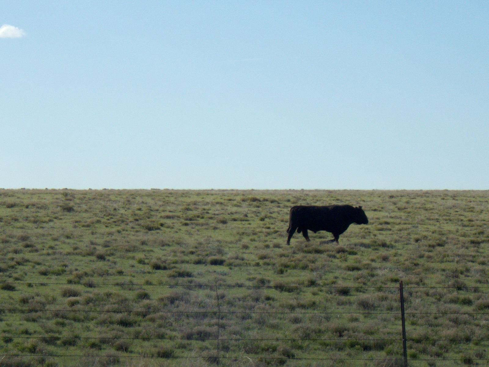
| Still raining a lot. These cows have dry land available, they just prefer the water. |
16. To Manhattan (map) - through Junction City but not Fort Riley.
KansasAnother transport stage. Trying to get out of the plains and into the forest, to avoid the winds.
 |
| Just bragging about early start again. |
 |
| Kansas sunrises are like sunrises everywhere. |
 |
| Kansas has twice as many cattle than people. These suffer in the heat, just like me. |
 |
| Staying away from this guy's yard. |
 |
| I laughed at the thought of tornado shelters being necessary. I stood corrected after watching the news 2 days later. |
 |
| Abilene |
All the fuzz was quite frustrating, and together with the long distance it caused some agony.
17. To Kansas City (map) - through Topeka and Lawrence.
Kansas, MissouriScorching hot day, with temperatures up to 36℃ (97℉).
 |
| Wamego City Park. Nice place. |
 |
| Still a bit of rain. |
 |
| Squirrels everywhere. |
 |
| Kansas State Capitol, Topeka. |
 |
| Trains. |
Dinner at McDonald's. Cheap, fast, and free wifi. I have no opinion with regard to nutritional content.
18. To Tipton (map). Knob Noster and Sedalia.
MissouriMore forest and greener for every passing day.
 |
| Greenwood. Safest city in Missouri. Hardly any cars, and 25 mph speed limit. Of course it's safe. |
 |
| Like mostly everywhere in USA, bikes are just good-looking props. |
 |
| Even the people in Pleasant Hill were pleasant: Smiling and greeting a stranger. |
 |
| There's something mysteriously relaxing about seeing grazing cows. |
 |
| Charming house. |
 |
| First cat I saw seen in USA was in Sedalia, Missouri. |
 |
| The magic eight-ball water tower of Tipton. Give it a shake and see what it says. |
In Tipton, I found a wonderful cheap motel (actually, not so wonderful, but very cheap), and decided to also spend a rest day there. The following day, it was forecasted rain, and I was also totally exhausted. Most of the day was spent in bed, with the exception of visits to the food market to buy bean- and cheese burritos.
On the rest day, it didn't actually rain much, so I could just as well have continued. It was extremely humid and warm - the kind of climate that causes tornadoes - which made the rest day not very comfortable.
19. To Caseyville (map) - Along the Missouri River after rest day. Entering Illinois from Saint Louis.
Missouri, IllinoisAnother long day planned. With fresh legs, and mostly flat terrain, I knew I should be able to make up for some of the lost time. Most of the day I was following the Missouri River. The terrain was mostly flat, with little or no road shoulder. There were few gas stations along the route, but the two litres of water I brought sufficed in-between stops.
At my lunch stop, the gas station attendant had a hard time understanding why I was cycling through exactly this area. Apparently, Missouri doesn't have many bike-touring cyclists.
 |
| Jefferson City bridge. |
 |
| Capitol building in Jefferson City. A tornado hit this city just a couple of days later. |
 |
| Missouri River a few metres higher than usual. Flooding everywhere, also on the news. |
 |
| If you're serious about farming, 4 wheels is not enough. |
 |
| Baseball. |
 |
| Spiked lug nuts. I wonder how many bicyclists this guy has killed. |
 |
| This was the only bison ox I saw. |
 |
| Saint Louis. |
 |
| Downtown Saint Louis. |
 |
| The famous arc of Saint Louis. |
20. To Carmi (map) - via Pinckneyville
IllinoisIllinois is a beautiful state, and not so unlike my home-country Norway. It had quite a few insects, which was annoying.
 |
| Belleville brags about it's poor city planning. |
 |
| Typical city view. |
 |
| Farm buildings. |
 |
| Church billboards were competing with beer billboards. |
 |
| Snowman. |
 |
| Those colors. |
 |
| Fishing on Rend Lake. |
 |
| In the mideast, it was not uncommon to have some sort of garden decorations. |
 |
| Better not be proud, or there'll be another couple of flat tires. |
 |
| Three geese flying over McLeansboro. Is it a sign??? |
Another bike shop visit was needed to stock up on new inner tubes. It was quite easy to get Continental inner tubes - which is my preference - but also a few dollars more expensive.
21. To Rockport (map) - via Evansville
Illinois, IndianaHeadwind, rain, chased by dogs, closed bridges, snakes, and flat tires. This day had it all. I even got lost in a garden labyrinth in New Harmony.
I did encounter a closed road, which was unexpected and I knew my planning on this stage had been insufficient.
 |
| Hello, friends. |
 |
| No turtles in Norway, so fun to see some. |
 |
| Your lack of bike maintenance is disturbing. |
 |
| Oh snap! I wonder if there's even a bridge up ahead any more ... |
 |
| Reaching the bridge. Entry to New Harmony, Indiana, granted! |
 |
| It's been raining a bit in Indiana lately, too. |
 |
| Wheat fields. |
 |
| Duck crossing. Charming ... |
 |
| Flat tire in Indiana, too. |
The road into New Harmony, Indiana, was particularly difficult since it involved a closed road. I climbed the concrete barriers, hoping that the road further on wouldn't be (even more) physically obstructed. There was a scary moment when I discovered that on the opposite side of the concrete barriers, there were snakes, and I was centimetres away from stepping on one
Also, on the opposite side of the Wabash river into New Harmony, there was a tall mesh fence blocking entrance, including federal warnings and all. It took a few acrobatic maneuvers, but it did save me 2-3 hours in detours.
Not sure the New Harmony bridge exists in the future. It is even removed from Google Maps now.
22. To Shepherdsville (map) - Tell City, West Point, and attempted break-in at Fort Knox.
Indiana, KentuckyWas hoping to avoid the rain, but no.
 |
| Yard decorations. |
 |
| Cool day, but the cows still love bathing. |
 |
| Old farm house. |
 |
| Stuck outside a liquor store in West Point. The owner didn't like me a bit, but she didn't know my hardships! |
 |
| The fence at Fort Knox looked too intimidating to climb. No visit to Bullion Depository today. |
 |
| All the rain today surely earned me a few bad-ass points. |
 |
| Welcome to Shephersville. Here's a tank. |
 |
| My 622mm Canyon CF SLX, 2016 & Shepherdville's 105mm M2A2, 1954. |
Shephersville is near a big army base, and people here appeared to be a bit more army-like than what I'm used to. Not so easy to talk with people. Strange place.
23. To Mount Sterling (map) - via Lexington.
KentuckyWhat's peculiar about Kentucky is that the farmland is all rolling hills, and properties are fenced up always with brown fences. There's probably a law that regulates it.
All the rolling hills made progress a bit slower, and daylight ended around Mount Sterling. Somehow I wish I had used bigger roads - it would have allowed me to cover at least 50 km more.
 |
| Not so modern gas station. |
 |
| Kindness in Kentucky did not strike me as a problem. |
 |
| Something felt very wrong about cycling into these clouds. |
 |
| Kentucky River. |
 |
| Not sure what this is ... |
 |
| Lexington. |
 |
| The cows are taking a bath again. I count 6. |
Cycling along Kentucky roads may not be easy with all the hills, but drivers were very mindful and gave me plenty of space. After Shepherdsville, I didn't experience any uncomfortable traffic situations at all.
24. To Hurricane (map) - via Huntington. Meeting the Ohio River.
Kentucky, Ohio, West VirginiaI will let the pictures do the talking on this one.
 |
| The green fields of Kentucky |
 |
| Railroad bridge over Licking River (near Salt Lick?) |
 |
| Cabell County courthouse, Huntington. |
 |
| Hippies are everywhere. |
 |
| East Huntington Bridge. Of course I had to visit Ohio as well. |
25. To Summersville (map)
West VirginiaAn old song from one of my favorite artists came to mind:
Almost heaven, West Virginia
Blue Ridge Mountains, Shenandoah River
Life is old there, older than the trees
Younger than the mountains, blowing like a breeze
Blue Ridge Mountains, Shenandoah River
Life is old there, older than the trees
Younger than the mountains, blowing like a breeze
A beautiful state, certainly, but it's not much there.
 |
| I am so glad I didn't have to vote in the previous U.S. election. |
 |
| West Virginia State Capitol, Charleston. |
 |
| Barges on the Kanawha River |
 |
| River locks on the Kanawha. |
 |
| Oooh! Waterfalls! |
 |
| Lawn-mowing in 35℃, understandable ... |
 |
| Sometimes the old can be prettier than the new. It's something with the colors. |
 |
| Summersville, pretty town at the west side of the Appalachian mountains. |
I hadn't planned to stay in Summersville, so therefore I ended up in another mid-range hotel slightly more expensive than my budget allowed. The extra comfort provided was probably an advantage, since fatigue had begun settling in.
26. To Franklin (map)
West Virginia, Virginia, West VirginiaAnother early start, at 06:50. On my mind this morning, was that I would miss the American waffles when this is all over. I expected a tough day with a lot of climbing, to get over the Appalachian mountains. The thought that there would be long stretches with no service was a bit alarming, although I knew I just had to take the chance it would be alright.
 |
| Early morning mist. |
 |
| What does the fox say? (He barked at me) |
 |
| Looks like the Limenitis arthemis astyanax, but it's not supposed to be in West Virginia, so I don't know ... |
 |
| Williams River along a closed-off access road. Quite an experience! |
 |
| Red Spruce Knob, 1260m altitude. |
 |
| They've been following me all the way from Kansas. Perhaps they are Secret Service agents? |
 |
| Love at first sight. Near Frost, West Virginia. |
The best part of this day was following the Williams river through an area mostly used by campers and 'catch & release' fishers. There were a few moments of doubt when I first reached this seemingly-closed road through the forest, which was not even on my GPS map. I thought that I had slipped up my planning, and accidentally plotted a hiking route through the mountains. But no - the problem was that I hadn't mentioned this speciality in my stage briefs and therefore forgot about it. A local farmer also confirmed that I'd be fine on my road bike further on.
Honorable mention to Red Lick Montain, part of the Highland Scenic Highway, where according to some guy I met in Mount Sterling, you can see most of the West Virginia mountains on a clear day.
I checked in on a charming motel at the outskirts of town with the most wonderful of owners. Behind the desk, it was hanging a sign that 'grumpy guests would be charged $10 extra'. I was not grumpy - perhaps a bit tired and wanting all this to be over soon, but I put on my nicest smiley face and avoided extra charges.
27. To Stephens City (map)
West Virginia, VirginiaBreakfast at a local gas station. A few old fellas outside tried to ask me something, but I couldn't understand a word they were saying. Appalachian English? Smiled and laughed a bit to try to shrug of the embarrassment - only partially successful.
 |
| Lovely ealy morning mist. |
 |
| Not much to see here, so posting a photo of a field. |
 |
| Valleys. |
 |
| Forests and a mailbox. |
 |
| Oh hey! Hayballs! |
Not much to report on. These roads were just mostly woods. However, people were always friendly and often began talking with me before I had the chance to open conversation.
28. To Baltimore (map) - cycling through Washington D.C.
West Virginia, District of Columbia, MarylandFinally. It was time to reap what was sown many days ago. I met a few people this day who were concerned with my mode of transportation towards D.C. I had to insist that it was safe, and that all precautions had been taken. It struck my mind that many of the drivers in this area could be politicians, and that my impression of politicians was that they probably wouldn't be mindful if a bicyclist comes in-between their SUV, and their high-paying D.C. workplace. So - extra careful.
 |
| Decorations along the cycling path. |
 |
| The W&OD railroad trail (see External Resources for map). |
 |
| Arlington. |
 |
| Arlington National Cemetery. Freedom has a price. |
 |
| Abe has a nice view. |
 |
| South lawn of the White House. |
 |
| Secret Service was out in numbers, Pacific Blue style. Hard to see, but some of them have bar ends on their bikes. Shameful! |
 |
| Capitol Building (senate & house of representatives). Fun to be here! |
 |
| Lots of pretty houses. |
 |
| A very appreciated moment when dead-tired. |
Heard on the Lincoln Park area: "Hey! You ain't no Lance Armstrong! Get out of the street!"
I did get out of the street, but that was only to fix another flat tire. The 12th. Also, stopping at a local grocery store to get water, I was "nearly assaulted" by what I've only previously seen on screen as a crack-addicted woman, asking for money. I willingly contributed some of my change, and shared my water. Reality check.
A fun experience to see the White House. I could tell that the Secret Service didn't actually like me and my bike with a big bag on it. I got a kind remark from one guard with an MP-5 to move my bike to street level, away from the fence. I was pretty sure he wasn't joking around, so I complied. Also, I parked my bike outside the Lincoln Memorial to run around for a few minutes to get some photos. That was enough for the vultures to again circle in on my (locked) bike. All this security is quite scary and takes a bit fun out of the experience, but I suppose it is necessary.
Dinner at Wendy's, and sleeping at Extended Stay Baltimore.
29. To Philadelphia (map)
Maryland, Delaware, PennsylvaniaAll I had in mind this day was to finish this thing and go home. So close.
 |
| I didn't quit. There were difficult moments, though. |
 |
| Baltimore. |
 |
| Patapsco river is technically an estuary, but this is SALTY WATER! |
 |
| Bridge over Susquehanna River. Bikes allowed - didn't feel very safe though. |
 |
| Newark, Delaware. Had it been in Newark, Pennsylvania, these geese would be seriously out of luck. |
 |
| Smith's Bridge, Brandywine Creek, Delaware. From 1839, rebuilt after a fire 2002. |
 |
| The industrial southern side of Philadelphia. |
When I reached the outskirts of Philadelphia, a NWS Severe Weather bulletin popped up on my phone, and I decided to shelter in the nearest hotel. That was problematic, because it would leave a lot of kilometers on the last stage, which was tricky city-cycling. I was not prepared to take any chances with cycling on slippery tarmac in the rain through a busy city.
30. To New York (map)
Pennsylvania, New Jersey, (New York)Pennsylvania was not a particularly easy city to ride through. Roads were dirty, with metal and gravel everywhere, causing two additional flat tires, bringing the total number up to 14, and with zero spare inner tubes. I also saw some fellow cyclists show off some of the most daredevil city cycling I have ever witnessed - with pedestrians literally jumping out of the way of said cyclists. So impressive that I almost wish I also didn't have any moral fibers.
The weather forecast was quite grim. I had a certain number of hours before thunderstorms would hit the greater New York area in force, with no apparent end in sight. Better hurry!
 |
| You and me both, bro. |
 |
| Philadelphia. |
 |
| Cyclists, runners, and apprentice-ninjas all sharing the same bike path. |
 |
| Street art next to Delaware River. |
 |
| One does not simply bike into New Jersey. |
 |
| Princeton. Many nice buildings. |
 |
| Dense traffic in Newark. |
The bridges I had selected into Jersey City turned out to be quite dangerous and not suited for cycling. I regret the choice of path, and would very much have preferred a quieter road even if it cost an hour more. None of the roads I cycled on were illegal for cyclists, but being inside the same lanes as cars put you at risk at meeting this one idiot looking at his cell phone - and it only takes one.
As I approached Hoboken, a slight drizzle started, and temperatures dropped. I knew it was a problem, but I was also prepared that this day might end early. There would be no cycling in New York City in the rain - rain in New York City means more traffic than normal, and also slippery roads.
So there I was, finally, on the doorsteps of New York City, at the end of what had been my biggest adventure yet. It felt like having put all the money on one hand and still won.
It's good to take a risk sometimes - as long as the risk is manageable.
 |
| Hoboken, Jersey City. View over to Lower Manhattan. |
 |
| Alright, I'm calling Uber! |
Epilogue
I didn't actually think it would turn out fine to park my rather expensive road race bike outside in Brooklyn overnight - but that's what the hotel clerk instructed me to do. Shivering, near hypothermia, hungry & not particularily keen on ever riding a bike again, I complied. Turned out fine! Brooklyn must be a particularly law-abiding and friendly place.The next day, I took a easy ride down to Steeplechase Pier, to enjoy the view of the Atlantic Ocean.
What a ride it had been.
 |
| Boardwalk. |
 |
| Steeplechase Pier. |
 |
| The Atlantic Ocean. |
But this wasn't the end of the adventure. In the evening, the flight home was first delayed for a few hours, before being cancelled. I was stuck in New York for two full days, which was spent mostly sleeping. Additionally, my bike was lost at JFK Airport for almost a week, before being found by TSA, who eventually sent it home to me.
Challenges
There were a number of challenges on this trip. I'd like to summarise them for posteriority, to show others interested in cycling long trips what they're up against.14 flat tires. Probably half of those are linked to insufficient tire pressure. If not having enough pressure in road race tires, you'll get more punctures. Also possibly aggravated by having a 3kg bag at the rear side of the bike, putting additional strain on the tire.
A fresh set of Continental GP4000 completely worn to shreds. Especially the rear tire had been worn down to the thread pattern, while the front tire had large lacerations due to impact with metal objects, and could therefore not be inflated to more than 80 PSI.
 |
| Not so fresh anymore. |
Not easy finding places that sell spare inner tubes. I bought every spare inner tube that Arizona had, it'll take time for them to restock.
Rythm. The day consists of cycling, washing clothes, eating, sleeping. Learn to love it.
Bringing bike into room at motels/hotels. It was allowed in 28 out of 30 hotels/motels. This was a road bike, kept clean, washed every day before entering the hotel. Not sure if something with gravel tires are allowed, though.
Cell phone coverage. AT&T coverage may be the best in the U.S., but it still sucks according to european standards.
Check your screws before long trips. When the bike returned to Norway, the derailleur hanger fell off when the bike was taken out of the box. I might have cycled across half of America with no screws holding the derailleur hanger to the frame.
Noise from freehub. Due to incorrect torque on mounting of the freehub of the bike, I had a problem with that having the freehub in free mode resulted in severe noise. A professional bike shop could easily make the same mistake - could be difficult to deal with such issues on the road.
When tired, strange decision ensues. Be safe in traffic. Don't take chances. Don't ride when tired.
Sunburn. Annoying, somtimes it's hard to protect against, even with high-enough SPF due to sweating. Sunburn kills motivation. Know the effects that sunburn have on your mind - take the rest day, don't beat yourself up over it.
Tornadoes. It's no laughing matter. Two days after leaving Jefferson City, Jefferson City was a rubble. 11 days after leaving Tipton, Tipton was a rubble.
Risk of earthquakes. Two months after cycling through Ridgecrest, Ridgecrest is rattled by one of the biggest earthquakes in a decade.
Flooding. Missouri River was on the brink of overflowing some of the roads I cycled along, with only 3 or 4 inches to go.
Planning resources
I used the following planning resources:- Strava Route Builder to find cycling friendly roads, and to create plans for each day.
- Google Maps to find shortest paths
- Spreadsheet with all stages, to score elevation/distance in order to keep maximum progress but keep the strain to an acceptable level.
The output was the following:
- Spreadsheet with all stages
- GPX routes for each day
- Risk assessment of the trip, with pitfalls that needed to be avoided (it was a good idea to think through this on beforehand)
- Stage-by-stage manual with gas stations, landmarks, where to be careful, etc.
Gear
The following gear I brought with me: |
| Some of the gear. |
- For travel to L.A. only: Throwaway set of clothes.
- Saddle bag content
- Hygiene
- Petroleum jelly (avoid chafing etc.)
- Sunscreen
- Toothpaste
- Floss
- Toothbrush
- Tools
- 2x USB cables
- Camera USB cable
- USB battery pack
- Chain hot link
- Pump
- Extra front and rear lights
- 13mm tool to adjust brakes
- Oil
- Wire lock (Abus 2501 Combiflex 65cm)
- Lezyne Zecto front light, 250 lm (250 lm is the absolute minimum that is useful, in my opinion)
- Spare battery for power meter.
- Documents
- Plans
- Spare money
- Extra credit card
- Civilian clothes
- Shorts
- Nylon pants
- Shirts (2x thin t-shirts)
- Underwear (1 set)
- Slippers
- Extra cycling clothes
- Drybag (red bag that is on some of the pictures)
- Buff
- Long legs
- Long arms
- Mesh superunderwear
- Pocket content
- Money
- Credit Card
- Passport
- On the bike
- Canyon Ultimate CF SLX 2016 road bike
- Garmin Edge 1000 GPS
- Apidura Top tube bag for camera and cell phone
- Camera (Olympus Tough TG-4)
- Apidura saddle pack (Compact version, 11L)
- USB battery 3000 mAh (mounted below Garmin unit with freezer tape)
- Code Lock
- Bottles, 2x 1L
- Front and rear mini lights (for tunnels) - important!!
Actual cost
35.000 NOK+ Airfare
+ Cash
- Reimbursement after NorwegianAir delays
Estimated around 40.000 NOK (4.600 USD).
The wear on bike equipment is not included. Gear cables, brake pads, bottom bracket and tires probably all need replacing.
Results
The following chapters detail the outcomes.Stages
The following stages were completed:| Stage (Link) |
From | To | Dist. (km) |
Time (hrs) |
Climb (m) |
Avg speed (km/h) |
Avg pwr (W) |
kCals | Avg HR (bpm) |
Avg temp (C) |
|---|---|---|---|---|---|---|---|---|---|---|
| 1 | Los Angeles | Palmdale |
131
|
06.06
|
2 145
|
21,5
|
163
|
3 029
|
126
|
15
|
| 2 | Palmdale | Ridgecrest |
150
|
04.50
|
803
|
30,9
|
141
|
2 189
|
109
|
18
|
| 3 | Ridgecrest | Furnace Creek |
198
|
08.16
|
1 998
|
24,0
|
167
|
4 258
|
116
|
19
|
| 4 | Furnace Creek | Pahrump |
100
|
04.45
|
1 335
|
21,1
|
147
|
2 314
|
104
|
24
|
| 5 | Pahrump | Chloride |
229
|
09.50
|
2 387
|
23,2
|
147
|
4 399
|
105
|
24
|
| 6 | Chloride | Seligman |
181
|
07.14
|
1 231
|
25,0
|
131
|
2 846
|
100
|
27
|
| 7 | Seligman | Valle |
120
|
04.49
|
1 142
|
24,9
|
136
|
1 936
|
100
|
25
|
| 8 | Valle | Tuba City |
189
|
07.47
|
1 633
|
24,3
|
137
|
2 940
|
102
|
16
|
| 9 | Tuba City | Mexican Hat |
191
|
06.24
|
1 211
|
29,7
|
145
|
2 810
|
101
|
16
|
| 10 | Mexican Hat | Farmington |
219
|
09.00
|
2 152
|
24,3
|
143
|
3 922
|
102
|
13
|
| 11 | Farmington | Cuba |
160
|
06.19
|
1 532
|
25,3
|
146
|
2 968
|
105
|
12
|
| 12 | Cuba | Eagle Nest |
253
|
10.06
|
2 630
|
25,0
|
150
|
4 875
|
109
|
8
|
| 12b | Eagle Nest | Clayton |
215
|
07.48
|
932
|
27,6
|
124
|
3 176
|
98
|
17
|
| 14 | Clayton | Dodge City |
335
|
10.42
|
425
|
31,3
|
133
|
4 813
|
103
|
23
|
| 15 | Dodge City | Great Bend |
143
|
05.32
|
196
|
25,7
|
106
|
1 975
|
94
|
26
|
| 16 | Great Bend | Manhattan |
260
|
10.45
|
989
|
24,2
|
123
|
4 240
|
97
|
24
|
| 17 | Manhattan | Kansas City |
212
|
08.59
|
1 420
|
23,6
|
111
|
2 955
|
92
|
30
|
| 18 | Kansas City | Tipton |
194
|
08.16
|
1 451
|
23,5
|
123
|
3 012
|
91
|
27
|
| 19 | Tipton | Caseyville |
291
|
10.58
|
2 325
|
26,5
|
134
|
4 418
|
96
|
20
|
| 20 | Caseyville | Carmi |
207
|
07.49
|
922
|
26,5
|
138
|
3 408
|
94
|
21
|
| 21 | Carmi | Rockport |
139
|
06.36
|
668
|
21,0
|
120
|
2 502
|
91
|
23
|
| 22 | Rockport | Shepherdsville |
175
|
07.09
|
1 455
|
24,5
|
137
|
2 994
|
98
|
20
|
| 23 | Shepherdsville | Mount Sterling |
197
|
08.53
|
2 062
|
22,1
|
122
|
3 186
|
24
|
|
| 24 | Mount Sterling | Hurricane |
212
|
08.33
|
1 582
|
24,8
|
130
|
3 367
|
28
|
|
| 25 | Huricane | Summersville |
157
|
06.45
|
1 269
|
23,2
|
135
|
2 795
|
27
|
|
| 26 | Summersville | Franklin |
212
|
08.39
|
2 253
|
24,5
|
147
|
3 811
|
20
|
|
| 27 | Franklin | Stephens City |
155
|
07.12
|
2 285
|
21,5
|
139
|
2 904
|
22
|
|
| 28 | Stephens City | Baltimore |
197
|
09.20
|
1 573
|
21,1
|
120
|
3 000
|
27
|
|
| 29 | Baltimore | Philadelphia |
161
|
07.03
|
1 380
|
22,8
|
115
|
2 222
|
31
|
|
| 30 | Philadelphia | New York |
182
|
08.17
|
854
|
21,9
|
122
|
2 992
|
21
|
|
| TOTAL |
5 763
|
44 240
|
96 256
|
Two rest days (before stages 12 and 19).
Conclusions
As for the main research question, was it a good idea, the answer would be No, due to USA not being a cyclist friendly country. If you plan doing the same, consider following approved cycling routes.Other observations include:
1. Riding across America is easy breezy from a technical perspective.
2. It may not be a good idea and is riddled with danger.
3. Long rides do not fix any life problems, but they are fun for sure.
Further Work
I have said to my friends that this is my last long trip, but I'm not so certain any more. It depends on if more exciting challenges appear. Planning for epic bike trips has a certain therapeutic effect.South America: Ushuaia to Caracas. Who's in!?
Thanks to A.C.E. for editing assistance & Thanks to all who followed me on Instagram and facebook!